Laguna-Mark West complex
Because the confluence of the Laguna and Mark West Creek varies so much depending on flood stage, it is referred to as the Laguna–Mark West complex.
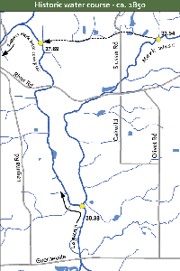
From 1850 to 2005-2006 
Mark West Creek has been altered repeatedly over the past century and now takes a 4.03 mile detour to the south at mileage point 33.54. (Dotted line shows the former course circa 1850.)
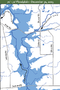
71 - 72' Floodplain
During events like the December 31, 2005 flood (which exceed 71'), this former watercourse—running north of River Road for its entire distance—re-emerges to carry a portion of the flood overflow. It reaches the Laguna 1.83 miles later at mileage point 27.69.
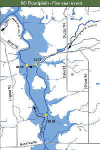
66' Floodplain
Every five years or so—during events that reach an elevation of 66 feet or more—Mark West Creek leaves its artificial channel at 31.73 (near Rued Creek) where it traverses a 0.20 mile course to reach the Laguna at mileage point 28.99, shortening its route by 2.54 miles.
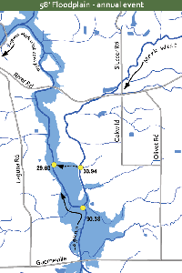
62' Breach point and 58' Floodplain
During typical annual floods that reach 62 feet elevation, Mark West Creek remains in its artificial channel until it reaches mileage point 30.94, where it breaches the artificial channel and takes a 0.35 mile route to reach the Laguna at mileage point 29.63 (show in dotted line), shortening the distance traveled by 0.96 miles. The 58'-foot floodplain, shown in blue on map, is the first stage of flooding. The Laguna and Mark West, during the dry season, join at elevation 57'.

